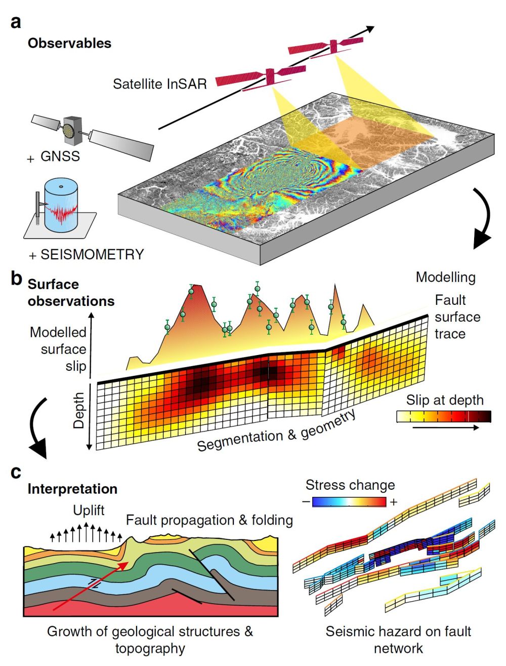
The quantity and quality of satellite-geodetic measurements of tectonic deformation have increased dramatically over the past two decades improving our ability to observe active tectonic processes. We now routinely respond to earthquakes using satellites, mapping surface ruptures and estimating the distribution of slip on faults at depth for most continental earthquakes. Studies directly link earthquakes to their causative faults allowing us to calculate how resulting changes in crustal stress can influence future seismic hazard. This revolution in space-based observation is driving advances in models that can explain the time-dependent surface deformation and the long-term evolution of fault zones and tectonic landscapes.
This review article has been published in Nature Communications and is Open Access and is freely available to download here: http://dx.doi.org/10.1038/ncomms13844.