The Rise of Mountains
I am a Royal Society funded University Research Fellow and I am researching the current growth of mountains. Mountains are created when continents collide, causing tectonic faults to move. Most faults are locked in the upper crust, slipping suddenly and catastrophically in earthquakes. An open question in the deformation of the continents is how strain (and therefore earthquake hazard) is distributed through the crust. I want to address the question of how a mountain chain grows; whether this is primarily along its edges, or is more pervasive. To discriminate between models of the distribution of strain within the crust, I will measure the rate of change in surface height across a mountain chain, the Tien Shan in Central Asia, hundreds of kilometres in extent.
Rates of horizontal motion on the Earth’s surface are known to high accuracy for large parts of the planet. However, the measurement of much smaller magnitude vertical motion has not been achievable with conventional methods. With the recent launch of a new fleet of satellites, it is now becoming possible to generate large regional velocity fields from space radar imagery. I will exploit these datasets to quantify the rates of relative mountain height change of the Tien Shan above the surrounding stable regions with accuracy better than 1 mm/yr.
I will use independent atmospheric models to correct for atmospheric noise, and incorporate information from the horizontal velocity fields estimated from regional GPS networks to solve for the vertical component of the radar derived velocity fields at a spatial resolution of less than 1 km. I will use the rates and spatial distribution of vertical motion to deconvolve varying contributions to uplift: from tectonics, to erosion and ice unloading. The resulting mapping of deformation will enable better assessments of earthquake hazard in the future.

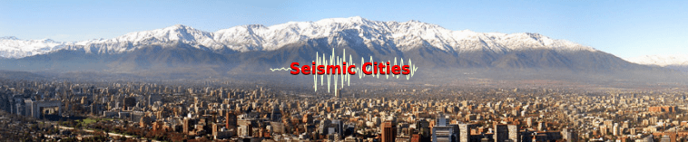
Seismic Cities
I am Principal Investigator on the joint NERC-ESRC-AHRC funded project Seismic Cities, part of the Global Challenges Research Fund (GCRF) Building Resilience call.
The long-term aim of the project is to address the sustainable cities and communities challenge in urban regions prone to earthquake hazard by increasing resilience to such seismic shocks. We believe that bringing together diverse actors with a focus on a specific “Seismic City” is a powerful mechanism to achieve this.
One of the key aims of this project is to develop a blueprint for the long-term Seismic Cities concept and to test ideas and methodologies in a city that has experienced a large earthquake in recent times, namely Santiago in Chile.
The Seismic Cities research team brings together a wide range of experts from the physical and social sciences from various institutes in the UK and Chile. To find out more, visit our Project Researchers page. We also have strong support from our industry and NGO partners.
New Zealand Earthquake Rupture – Urgency Grant
I am a Co-Investigator on the NERC funded Urgency Grant to measure the fault rupture following the 2016 Kaikoura earthquake in New Zealand. The earthquake started around 9 km north of Culverden on the South Island, and rupture on the fault plane propagated rapidly northwards in a complex pattern along a series of nine separate faults, with dramatic surface ruptures (with up to ~10m of horizontal slip) and large-scale landsliding between Kaikoura and Blenheim. The earthquake is remarkable for several reasons – it is probably the largest earthquake event dominated by horizontal movement to occur at a time and location where there were many scientific instruments already operating to record the seismic waves and determine the ground motion.
The earthquake occurred mostly on land, meaning that we are may be able to reconstruct what the sense of movement was from features such as roads and fences that were broken and moved during the event. Furthermore, the event was complex, with slip on multiple faults of different type, and with large variations in slip over short distances.
We plan to undertake two main tasks: i) to record key selected examples of these temporary landscape features before they are destroyed by surface processes, as soon after the event as is possible, to help tell the difference between initial fault slip during the earthquake from post-seismic movement, and ii) to emplace a number of semi-permanent GPS recorders which record their ground position to within a few cm, to capture the rate and timing of post-seismic movement over a period of around 3 months. Both of these tasks are critically time-dependent for reasons of preservation (weathering and erosion) and contamination (e.g. new deposition of sediment above the surface features).

Looking Inside the Continents From Space
I am a Researcher Co-Investigator on the NERC funded project Looking inside the Continents from Space: Insights into Earthquake Hazard and Crustal Deformation. The aim of this project is to capitalize on the launch of the Sentinel-1 radar satellites to create a revolution in satellite geodetic imaging, which, together with other advances in satellite observations, will enable us to:
(i) Construct high-resolution velocity and strain-rate fields for the Alpine-Himalayan belt and East African Rift, including the vertical component of motion for the first time.
(ii) Map faults in areas of the Alpine-Himalayan belt where their locations are still poorly known.
(iii) Measure temporal variations in the rate of strain across faults.
(iv) Obtain new information about the rheology of the continental lithosphere.
(v) Test models of continental deformation through numerical calculations.
In this way, we will shed new light on the following scientific questions:
(a) Why is continental deformation distributed as it is, and hence why do earthquakes occur where they do?
(b) How do observed rates of strain change with time throughout the earthquake cycle? What are the appropriate models that can explain these variations?
(c) What is the role of magmatism in continental rifting, and how does this vary in space and time?
This new information and understanding will enhance the assessment of earthquake hazard in the continents.

COMET
I am an Associate Member of the Centre for Observation and Modelling of Earthquakes, Volcanoes and Tectonics (COMET). This organisation is a NERC Centre of Excellence that uses satellite measurements alongside ground-based observations and geophysical models to study earthquakes and volcanoes, and help understand the hazards they pose.
Since April 2014, we have been working in partnership with the British Geological Survey (BGS) to deliver cutting-edge research on earthquakes and volcanoes as well as hazard monitoring services. We also work closely with the Natural Environment Research Council (NERC), National Centre for Earth Observation (NCEO) and European Space Agency (ESA), as well as many other national and international partners.
Earthquakes Without Frontiers
I was previously a Postdoctoral Researcher in the Earthquakes without Frontiers project. This is a NERC funded partnership for increasing resilience to seismic hazard on the continents.
The Earthquakes without Frontiers partnership brings together a group of earth scientists with a long track record in integrated earthquake science, social scientists that have extensive experience in exploring the vulnerability and resilience of communities in disaster-prone regions, and experienced practitioners in the communication of scientific knowledge to policy makers (see links for partners).
The project has three overarching objectives:
- To provide transformational increases in knowledge of the distributions of primary and secondary earthquake hazards in the continental interiors.
- To identify pathways to increased resilience in the populations exposed to these hazards.
- To secure these gains over the long term by establishing a well-networked, trans-disciplinary partnership for increasing resilience to earthquakes.
In each of the earthquake-prone regions on which the project will focus, we will be working closely with local scientists, policy-makers and organisations, both government and non-governmental.
![]()
